|
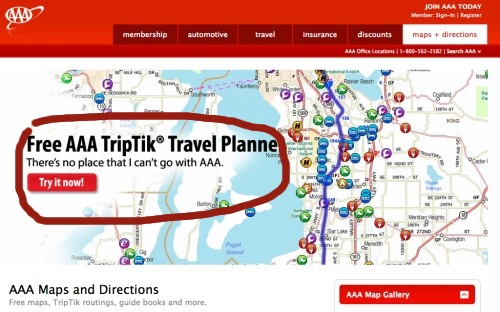
Washington State Map: How to Use the AAA's FREE Washington State Road Map ServiceThis guide to using the AAA's TripTik Washington State map service will help you to navigate around the beautiful Washington Coast region. Because the service is provided by AAA, you can be certain it is a high-quality Washington State road map. Before you travel, you should plot your route carefully. Unlike printed maps, this AAA detail map of Washington State will always be up to date. Washington State Map: Step by Step InstructionsIt can be quite a challenge to find the map function, and some of the controls are counter-intuitive, especially if you're used to using Google Maps. Start at the home page: http://www.aaawa.com/ You'll see a screen that looks like this (the large pictures at the top may change, or rotate while you're looking at the page). Now you need to click the "Maps and Directions" button on the big red bar at the top right of the page.
This takes you to the welcome screen for the TripTik map system. This screen can be pretty overwhelming. There's a lot going on here. But you want to click on the red button where it says "Free AAA TripTik Travel Planner" on the left-hand side.
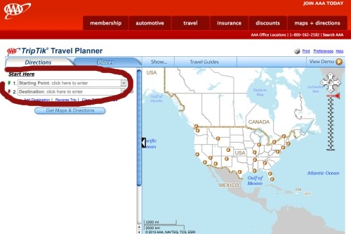
You should now see a satellite's-eye view of the entire United States map. For TripTik to be useful, we're going to need to enter two locations, a starting and finishing point. You can use a street address if you wish, but a city will give you the majority of the information you'll need, especially for longer journeys. Click on the box on the left where it says "Starting Point: click here to enter".
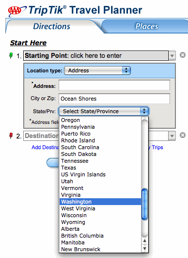
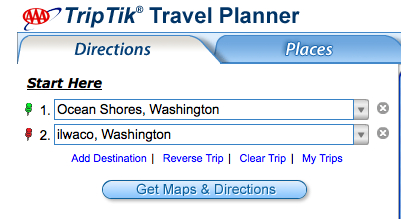
You can see I entered "Ocean Shores" as the starting city. A drop-down menu must be used to select the State you want. I've selected "Washington".
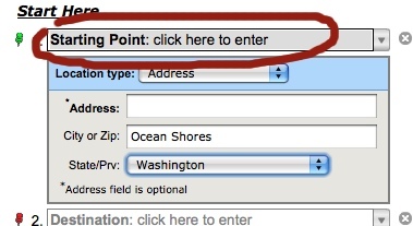
Potential stumbling block! You still need to click where it says "Click here to enter", otherwise nothing will happen!
Repeat the process for your finishing point. I used Ilwaco as the destination.
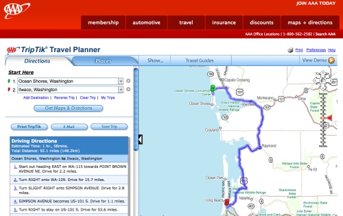
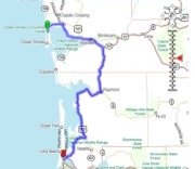
Now you'll see your route laid out on the map. Your journey will be highlighted in purple. The map will "zoom" to the most detailed level that still shows the entire journey plotted.
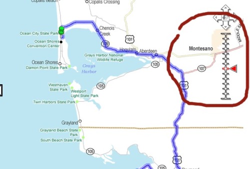
On the right of the map, rather like Google Maps, you'll see a zoom tool. This allows you to adjust the detail, from satellite right down to street view. I've circled this in red in the following image.
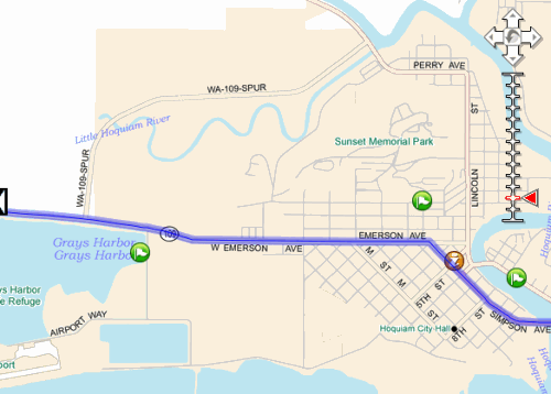
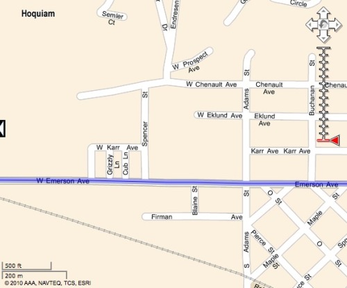
Here's a detailed City view:
And the most detailed level, Street view. Note that TripTik does not have Google Maps' funky (but not very useful) actual images of houses and landmarks.
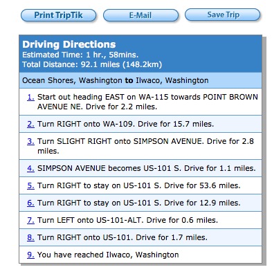
The most useful function is the ability to print out directions for the entire trip. Google Maps struggles with really useable directions. TripTik's are much better. The option to print them is in the blue and gray box on the left of the map area:
AAA's TripTik Washington State Map ConclusionI found it quite easy to use TripTik. It would be a very convenient alternative to carrying lots of road atlas books in the back of your car. The detail view may not be detailed enough for some tastes, so if you're looking for a detail map of Washington State, you might want to invest in a printed one on Amazon. Please sign up for my mailing list. AAA and TripTik are trademarks of the American Automobile Association. Images used with kind permission of the American Automobile Association. Go from Washington State Map to the Washington Coast Adventures home page |
What's Your Adventure?
You will want to check out these terrific videos selected just for you on our Facebook page right here...
Washington State Tourism Event Calendar
How to use the Washington State map at AAA


Have a story to share?
Send us your Washington Coast Memories,
Photos or Traveler Tips!


